Apartments, Houses and Chalets for Sale the Central Dalmatian Islands, Croatia.
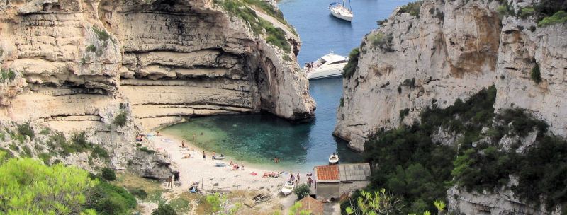
Stiniva-beach on the island of Vis
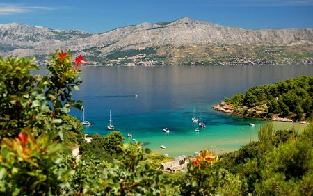
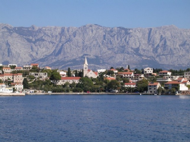
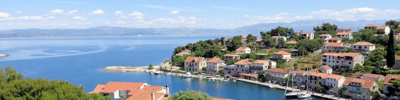
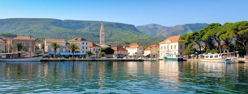
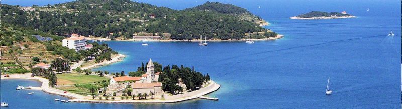
Brač, Hvar and Vis
These islands of Hvar, Brač, Vis, Solta, Ciovo and some smaller islands belong to the group of Central Dalmatian islands.
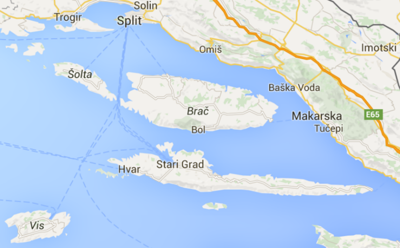
Map on Central Dalmatian Islands
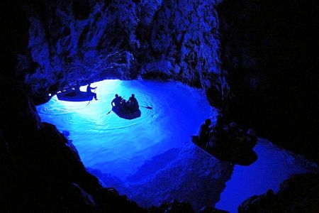
The Blue Cave in the Balun Cove
The islands of Hvar and Brač are favorite trendy destinations which attract tourists with an ideal combination of nature, culture and fun.
The island of Vis is the farthest settled island along the Adriatic, with hidden coves and beautiful beaches within walking / sailing distance, much like the islands of Solta and Ciovo for those that are looking looking for even more peace and quiet to recharge batteries and revitalize both body and soul.
The Island of Brač

Zlatni Rat, the long pebbly beach at Bol
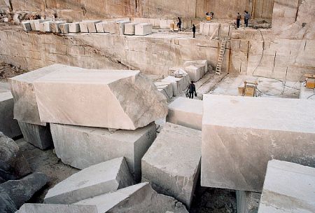
Brač quarry
Brač is famous for two things: its radiant white stone, from which Diocletian’s Palace in Split and the White House in Washington, DC (oh, yes!) are made, and Zlatni Rat, the long pebbly beach at Bol that sticks out lasciviously into the Adriatic and adorns 90% of Croatia’s tourism posters.
Well not quite - it would have been impractical to import foreign stone when the White House was built in 1792.
However . . . .

Brač - school of stonecutters
Brač stone was used as decorative trim on some of the White House mantel pieces in the 1902 renovation. The stone also may also have been used in the 1952 renovation initiated by President Harry Truman.
The island`s milky white stone does
- grace the Reichstag in Berlin,
- the Parliament Building in Vienna,
- the Diocletian`s Palace in Split
- and the Cathedral in Sibenik

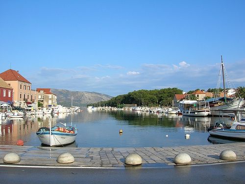
Brač Island
Transport on the Brač island
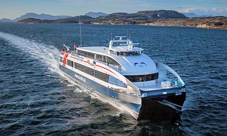
Inter-island katamaran
Car ferries connecting the island with the mainland depart daily from Split and Makarska. There is also a year round catamaran line connecting island with Split, and with the island of Hvar.
Ferry website
There is a small airport on the Brač island, mostly used by charter planes. There is a regular charter from Vienna to Brač during summer months.
Airport website

Brač island airport
Busses
Autotrans is the main bus operator on the island.
All villages on the island have a direct bus to Supetar, but the buses between other villages on the island are not always direct.
Buses have different schedule for summer and winter. Detailed timetable can be found at Autotrans Website.

Brač Island: Practical info
- Ferries to Brač Island leave from Split (to Supetar), and from Makarska (to Sumartin). The main ferry operator is a national company – Jadrolinija.
- Ferry from Makarska is less frequent (winter or summer) and smaller (it can only take up to 25 cars)
- Ferry has two schedules:
winter (from October to May);
summer (June to September)
In high season (July, August) you need to arrive to the port at least 2 hours in advance to make sure you board your desired ferry. - Ferry from Split takes 50 min to reach Supetar, while a ferry from Makarska takes 60 min to reach Sumartin
- There is a catamaran service from Bol to Split, and to Hvar (in case you don’t travel by car)
- Buses on the island are infrequent and slow
- Roads are good and safe; however a road going down to Bol is windy, steep, and full of serpentine (but the view is gorgeous!)
- Bol is the most popular place for tourists with most facilities, and the nicest beaches. Its all a matter of personal preference.
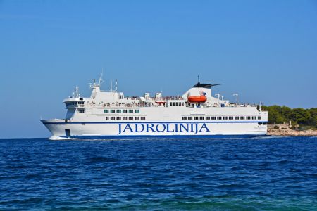
Jadrolinija Ferry
Hvar town, the Marina

Zlatni-rat beach, Bol
The Island of Brač: Places
Essentially the Island of Brač has two distinct areas: the coast and inland.
Brač - South shore
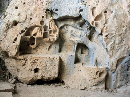
Dragons cave, Murvica, South shore
Locals however like to distinguish between the south and north shores of the island as well.
They are right!
Both shores have their unique and distinct attractions, but they do differ.
The south side of the island is far more touristy. It has more hotels and other tourist facilities, and it unquestionably has the prettier and gentler (and more crowded) beaches.
Lovrečina bay, Postira, South shore
Just twenty years ago, The north side had virtually no tourist industry at all, other industries dominated there (stone masonry, quarries, sardine factory, candy factory, etc…).
Even now, there are no big hotels there, just family-run B&Bs, apartment rentals, and generally a more residential atmosphere.

The Town of Bol, Brač, South shore
The village of Sumartin, Brač
Bol is the largest tourist center on the island.
Located at the south side of the island, Bol has wonderful beaches (Zlatni Rat - the most photographed beach in Croatia), good restaurants….
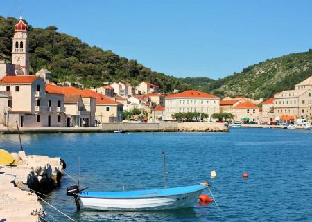
Sumartin is a small fishing village on the east side of the island. Sumartin is, after Supetar, the main entry point for Brač. Sumartin is connected to the mainland by a ferry service from Makarska.
It is a quiet place, with a nice Franciscan Monastery.
The village of Pucisca, Brač
Povlja is a small village located 10 km east of Sumartin, in a bay of the same name, Povlja is a quiet place, stone houses line the seafront. The surrounding bays conceal nice beaches, some rocky, some pebble. A perfect place to unwind, enjoy swimming, and other water sports.
Pucisca is an attractive village on the north side of Brač . Pucisca is the center of stone masonry on the island of Brač. The school for stonemasons is still active, with 100 students enrolling annually. A good place if you want to avoid crowds.

The village of Postira, Brač

Trstena bay, Postira, Brač
Postira is village located on the north side of the island. Postira is better known for its fishing than as a touristy village. One of the best Croatian pilchard producers is located in Postira. Their Adriatic Queen sardines, mackerels, and tuna are of an excellent quality.
The nearby beaches Prvija, Zastivanje, Mala Lozna, Trstena, and the sandy beach Lovrečina are popular with both locals and tourists.

The village of Splitska, Brač
Splitska is located only 8 km east of Supetar. Splitska is a small village, consisting mainly of family houses. A typical Croatian coastal village, Splitska is located in a small bay, with palm trees and stone houses lining the seafront.
Splitska used to be a loading port for the stones of Brač that were used to build a Diocletian Palace in Split.
One can visit remains of ancient Rasohe quarry where the stone figure of Hercules still stands.

The Marina of Supetar, Brač

The Town of Supetar, Brač
Supetar is the main entry point for Brač , and the island’s administrative center. Located on the north side of the island, Supetar is just a 50 minute ferry ride from Split.
It has a seafront lined with cafes a bit reminiscent of the Split Riva.
Supetar is the largest settlement on the island of Brač with some 3.300 inhabitants.
The "Split Gate" between Šolta and Brač

Milna Bay and Milna, Brač
Milna is a small town located on the west side of the island. The town is located in a protected bay, and not far from the “Split Gate”, the gap between the islands of Brač and Solta. Not to be confused with Milna on Hvar.
This is the reason why Milna is a very popular port for sailing boats and yachts.
The surrounding villages of Lozisca, Bobovisc, and Bobovisce by the sea are interesting to explore.

Škrip, Brač - By Esculapio (Own work) [CC BY-SA 3.0], via Wikimedia Commons
Škrip is the oldest settlement on the island, and a must-visit village on the Brač Island. It has an interesting Native Museum, remnants of old castles, and ancient city walls, and also the Museum of Olive Oil. Škrip is tiny, but it’s really interesting.
Nerezisca, is a small inland village, with that famous church with 200 year old pine growing right through its chapel.
For more information on Brač Island see the Brač Island Travel Guide

Blaca Hermitage - Pustinja-Blaca, Brač
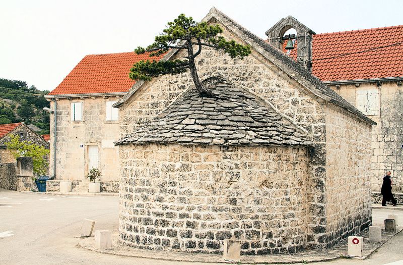
Nerezisca church with pine in the roof, Brač
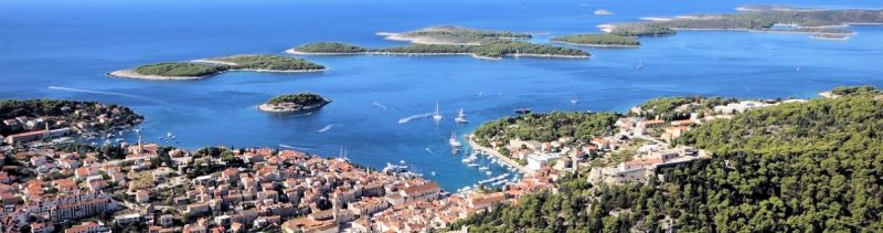
The Island of Hvar
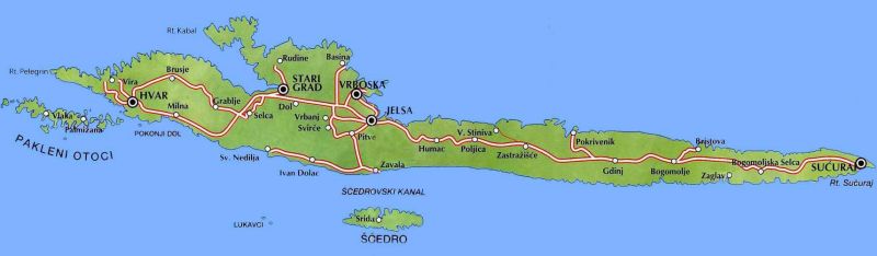
Map of the Island of Hvar
Hvar is an island of lavender, red wine, olives and of sometimes celebrities.

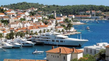
The town of Hvar and the Pakleni Islands

Palmižana beach, Hvar
Hvar is the number-one holder of Croatia’s superlatives: it’s the most luxurious island, the sunniest place in the country (2724 sunny hours each year) and, along with Dubrovnik, the most popular tourist destination.
Hvar Town, the island’s capital, is all about swanky hotels, elegant restaurants, trendy bars and clubs, posh yachties and a general sense that, if you care about seeing and being seen, this is the place to be. The coastal towns of Stari Grad and Jelsa, the cultural and historical centers of the island, are the more serene and discerning spots.
Romantic beaches, Hvar
The island of Hvar is the queen of the Croatian Dalmatian islands. It has been famous since the antique because of its important strategic and nautical position, the rich of the various historical periods, the culture and natural monuments.
Hvar is part of the central Dalmatian archipelago with the area of 299.6 sq km (length 68.2 km, width up to 10.5 km) and population of 10,648 inhabitants.

Sućuraj on Hvar Island
Stari Grad Port
The major places (all on the coast of the island) are:
- The town of Hvar,
- Stari Grad,
- Jelsa,
- Sućuraj and
- Vrboska.

Sveta Nedilja
Other places on the coast are:
- Milna,
- Sveta Nedilja,
- Ivan Dolac and
- Zavala.

Lavender Fields of Hvar
Places which aren’t on the coast are:
- Brusje,
- Grablje,
- Selca kod Starog Grada,
- Dol,
- Rudina,
- Vrbanj,
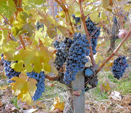
The grapes of Hvar
- Svirče,
- Vrisnik,
- Pitve,
- Humac,
- Poljica,
- Zastražišće,
- Gdinj,
- Bogomolje
- and Selca kod Bogomolja.

The Lavender Fields of Hvar
Places on Hvar
Hvar - Harbour & Pakleni Islands
The town of Hvar, with its 4000 inhabitants, is the largest settlement on the island of Hvar. It is situated on the south-western coast of the island, in a cove protected by Pakleni Islands.
Hvar town is a known playground for the rich and famous.
Hvar Town has winding cobbled streets, a yachts-lined seafront and plenty of beaches, restaurants, and clubs where partying can go on until wee-hours.
Hvar - Stari Grad (ancient Pharos)
Stari Grad (ancient Pharos) is a town and harbour at the end of the four mile long bay on the northern side of the island. Vineyards, olive-groves and pine tree forests surround the town. Chief occupations include farming, viniculture, olive growing, fruit growing, grapes processing, fishing and tourism.
Jelsa is a small town situated in a bay on the northern coast of the central part of the island of Hvar. It is adjacent to the two highest peaks on the island: St. Nicolas on the west and Hum on the east.
Jelsa comprises of two main parts: Vela Banda on the southern coast and Mala Banda on the northern.
Hvar - Jelsa

Hvar - Sućuraj
Sućuraj is a small scenically pleasing fishing and tourist town and harbour, on the east cape of Hvar Island; the nearest point (5 km) to the Dalmatian mainland.
Sućuraj is located where the crystal clear Hvar Canal and Neretva Canal merge with the magnificent background of Biokovo mountain and the Makarska Riviera, Brač Island, the Peljesac Peninsula and Korčula Island.

Hvar - Vrboska
Vrboska is a small town and a harbour on the central part of the northern coast of the island of Hvar. It lies in a narrow and deeply indented bay, surrounded by vineyards, olive groves and a forest of pine.
Milna is situated a distance 6 km from the town of Hvar, in a protected cove with two sandy beaches, separated from each other by a pine forest.
Not to be confused with Milna on Brač
Hvar - Milna

Hvar - The Marina in Sveta Nedilja
Sveta Nedilja (Holy Sunday in English) is a small village on the southern side of the island of Hvar.
Located below St. Nicholas (the island's highest peak - 626 m) and about 12 km east of the Hvar town.
There are about 150 inhabitants, mostly live from viticulture, olive-growing and tourism.

Hvar - The Marina in Sveta Nedilja
Ivan Dolac is a touristy village situated on the southern part of the island of Hvar, 10 km from Jelsa, 20 km from Stari Grad and 38 km from the town of Hvar.
Ivan Dolac also is famous for its vineyards that pruduce a wine of extraordinary quality.
This exeptionally good wine, Ivan Dolac, is ruby coloured and reflects the environment where it is produced. One can definately taste the of aromatic plants (lavender and rosemary) and other flora of Mediterranean climate. A powerful wine - slightly bitter taste with a full bouquet. Good with game and red meat, as well as Mediterranean delicacies.
The Ivan Dolac Barrique 2008, won the organic gold as Biofach Mundus Vini in Germany last year, for the second year (2014 and 2015).

Nautilus-Bay, Zavala, Hvar
Zavala is a village and small harbour on the southern coast of the island of Hvar, 13 km south of Jelsa, situated on the south side of the island Hvar. Zavala is famous because of its untouched nature and beautiful gravel beaches.
Across the sea from Zavala is the island of Šćedro, a true natural paradise, while the villages Ivan Dolac and Sveta Nedjelja are located in the immediate vicinity. It is a picturesque village, on a slope by the sea with several beautiful pebble beaches.

Lavender fields, Bogomolje, Hvar
Bogomolje is a small village located in the eastern part of the island of Hvar, some 19 km west from Sućuraj and 32 km east from Jelsa.
Although the village is located inland of the island, it has good beaches, in coves, on both south and north side of the island.

One of the Bogomolje coves, Hvar
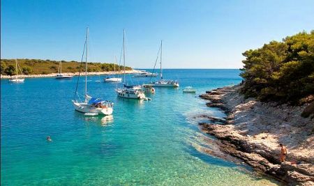
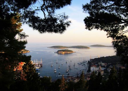
The Pakleni Islands
Pakleni Islands as seen from Hvar

Pakleni Islands
Pakleni Islands just across the sea from Hvar are an archipelago - just a quick boat ride from the town of Hvar. One can reach the islands by a private taxi boat, or simply rent a boat for a day and explore the islands by oneself.
The Hvar Adventure Tour Company also offers a kayaking tours to the Pakleni Islands, with a swimming and snorkeling break at the less visited beaches on the islands.
The Pakleni Islands by Kayak
These islands are stunning, with lots of bars, restaurants, but also pretty and secluded beaches.
The sea is azure blue with very good visibility.
The most popular beaches are a sandy beach Perna, and pebble beaches of Vinogradisce Bay.
The Hvar Adventure Tour Company website.
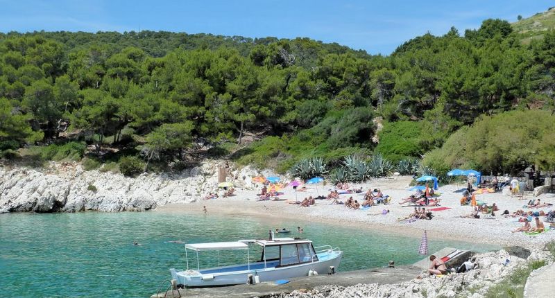
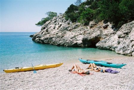
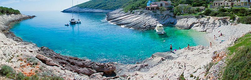
Vis and the Outer Islands
Vis Bay, Vis
Beach in Komiza Bay, Vis
Of all the Croatian islands, Vis is the most mysterious – even to locals. The furthest of the main central Dalmatian islands from the coast, Vis spent much of its recent history serving as a military base for the Yugoslav National Army, cut off from foreign visitors from the 1950s right up until 1989. The isolation preserved the island from development and drove much of the population to move elsewhere in search of work, leaving it underpopulated for many years.

Bay, Island of Vis
As it has happened with other impoverished islands across the Mediterranean, Vis’ lack of development has become its drawcard as a tourist destination.
International and local travelers alike now flock to Vis, seeking authenticity, nature, gourmet delights and peace and quiet.
The Island of Vis

Hidden Cove, Island of Vis

AKA Stiniva beach, Vis
There are only two towns on the island, Vis (2,000) and Komiža (1,800), both towns are located by the seacoast.
There are smaller settlements on the island's interior: Podselje,
Marinje zemlje,
Podspilje, and
Podstrazje.
The Town of Vis

The town of Vis
On the northeast coast of the island, at the foot of a wide, horseshoe-shaped bay, lies the ancient town of Vis, the first settlement on the island. In only a short walk you can see the remains of a Greek cemetery, Roman baths and an English fortress. Ferry arrivals give spurts of activity to an otherwise peaceful town of coastal promenades, crumbling 17th-century townhouses and narrow alleyways twisting gently uphill from the seafront.
The Town of Komiža

The Town of Komiža
Komiža lies on the sunny side of the island and is well sheltered from cold northerly winds, in the bottom of the largest bay on the island and compacted within narrow alleys and slender houses.
Komiža faces south-west, towards the open sea and its horizon is constrained by the islands of Biševo and Svetac. In the winter time, when the rain cleans the sky and the Bura (north-easterly wind) chases the clouds away, at dusk a new "island" appears between Biševo and Svetac... the peaks of the Majella mountains (elev. 2800m), 195 km away in Italy.

The Town of Komiža
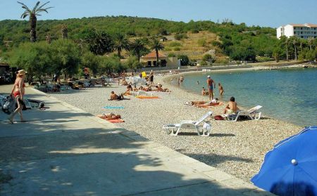
Island of Vis: Beaches
The Mala Travna Beach on Vis
The Prirovo Beach on Vis
Prirovo Town Beach: The town beach on the Prirovo peninsula extends over around a hundred metres of terrain and is covered with fine pebbles and round stones.
The beach is surrounded by tamarisk trees which provide a pleasant shade.
Close to the beach there is a catering facility and beach volley and futsal courts.

Punta od biskupa Beach on Vis
Punta od biskupa (Bishop’s Cape): This is a naturist beach that extends from the Stonca Bay to the Islet of Host along the inclined stone boards and rocks of the north-western part of the port of St. George.
Access to the beach is facilitated by an asphalt path.
Shade can be found only at the beginning of the beach.

Vela Svitnja Beach on Vis
Vela Svitnja Beach: Is located beneath the George fortress and is the first bay on the western part of the Port of St. George.
Dedicated to naturists, this beach extends over rocks and boards on both sides of the bay. It is approachable by footpath which, lowers from the road to Parja and Rogačić through the vineyards.
There is no shade on this beach.

Grandovac Beach on Vis
Grandovac Beach: is a beautiful pebble beach in the bay of the same name.
Grandovac Beach is located in front of the eastern entrance to Vis port. Rich with shade provided by tamarisk and pine-trees, it is ideal for families with small children.
Very close by is a small bar as well as a sunbathing area that was built way back in the 1930s.
Stončica Beach by boat
Stončica Beach: is the name of the lighthouse and cape, the long bay and the small fishermen's and tourist settlement, the sandy beach and an excellent restaurant. There is a small bar on the beach itself, a beach volley court and lots of shade under the palm trees on the western part and under tamarisk trees on the eastern part of the beach making Stončica an ideal choice for family excursions. The road from Vis leads to an asphalt path along which, on foot, the beach can reached in ten minutes.
Milna Beach on Vis
Milna Beach: is a sandy beach located at the bottom of the bay of the tourist settlement of Milna on the south-eastern part of the island. There is no natural shade before late afternoon. However, it is possible to rent a beach umbrella and deck-chairs. The shallow water remains knee-high for the first thirty meters from the beach. This is why it is the best beach on Vis for picigin (a local ball game). Two roads lead to Milna: the old road across Podstražje and the new one across Stončica.
Zaglav Beach on Vis
Zaglav Beach: Located on the south side of the island, well protected from northern winds, Zaglav beach is probably the most desirable beach on the island. One of the most attractive sandy beaches of the island, fine sand and crystalline waters.
Access - a 10-15 minutes walk from the beach at Milna or in a small boat.
One of the houses on the beach has a small terrace with a cafeteria that is open during the summer months.
Recommendation: Zaglav Beach is a day trip destination. Carrying everything you need in backpacks, because after 15 minutes of walking in the sun, you will find one of the most attractive beaches of the Adriatic....

Zaglav Beach panoramic on Vis

Srebrena Beach on Vis
Srebrena Beach: The beach received its name from the silver shine of its round stones under the moonlight.
It is the most famous beach on Vis. Plenty of pine forest for shade; Srebrna is the most common choice for families with children. The large and spacious stone area that gently descends to the finest beach on the western part is partly covered by pine-trees.
Path to car park just 250 meters.

Tepluš Beach on Vis
Tepluš Beach: Another pebble beach and a favorite amongst children. The beach is located on the south-western part of the bay, in front of the fishermen's and tourist settlement of Rukavac.
Although shade can only be found in the small pine-tree forest above the beach, a large stone area to the northern part of the bay is shaded from around five pm. The asphalt road from Rukavac separates from the road to Srebrna and leads to a spacious car park very close to the beach.

Bili Bok Beach on Vis
Bili Bok: is the name for the large stone area that, like terraces, continue one after the other, starting from the eastern cape of Srebrna Bay in an easterly direction, to the Punta od Polivala Cape. Each terrace is visually a separate unit. Discovered by naturists a long time ago and incorporated within the Vis map as a top naturist beach. The footpath through the pine-tree forest leads from the car park, due south, over the open area above Srebrna.

Mala-Travna Beach on Vis
Mala-Travna Beach: is a beautiful little bay located on the southern part of the island and surrounded by inclined plateaus that lower into the crystal clear sea which is always a few degrees colder when compared to the nearby Srebrna. The reason for this phenomenon are the fresh water springs in the bay as well as the always present western current that turns the shallow sea around the capes in small fast currents. Innkeeper Senko from Mala Travna offers food and drinks in the bay.
The bay is accessible via an asphalt trail.
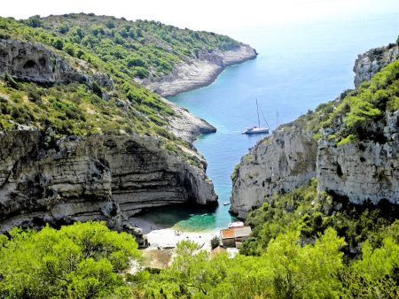
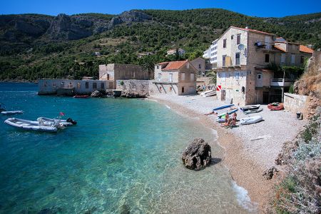
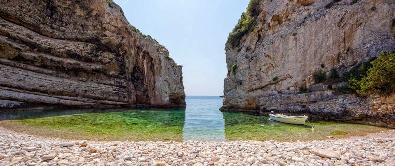
Stiniva Beach on Vis
Stiniva Beach: On the western part from Mala Travna is Stiniva Bay. Stiniva is enclosed in by two high rocky cliffs which, at their closest point, are just four meters apart. Between them is a strikingly beautiful pebble beach.
After sailing through the 'gateway' the scene open into a Roman amphitheater-like auditorium paved in stones.
From the land side Stiniva Bay can be reached by a steep and at times very demanding goat's path.
Think twice before deciding to go on this adventure with small children - you will soon have to carry them on your back.
Surrounded by high cliffs on all sides, Stiniva has at least one side in the shade.
The footpath can be reached via the hamlet of Žužec by road. The decent via the footpath will take a little more than twenty minutes.
Stiniva Cove on Vis