Apartments, Houses and Chalets for Sale on the Islands of Pag, Ugljan, Pašman, Vir, Dugi Otok, Ist, Molat, Silba, Olib, Kornati, Murter, Prvic, Kaprije, Iž, Krapanj and Zirje.
The North Dalmatian Islands

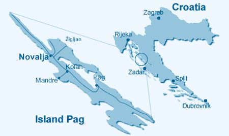
Map of the North Dalmatian Island
The North Dalmatian islands
This group of islands is made up of Pag, Ugljan, Pašman, Vir, Dugi Otok, Ist, Molat, Silba, Olib, Kornati, Murter, Prvic, Kaprije, Iž, Krapanj, Zirje, and a number of other smaller islands.

The North Dalmatian Islands
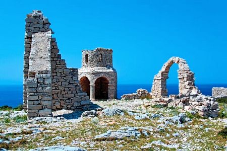
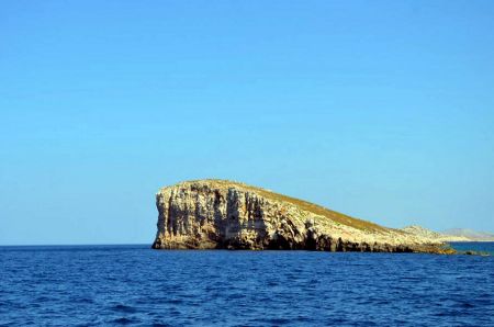
Dugi Otok
the island of olive plantations
A place where Picturesque villages and secluded beaches collide with majestic cliffs and lush vegetation.
Dugi Otok is a genuine example of an island where these two opposites are both observable and truly mutually beneficial.

Sakarun Beach on Dugi Otok

Sakarun Beach on Dugi Otok
This island is about 45km long, and its width varies from 1 to 4km.
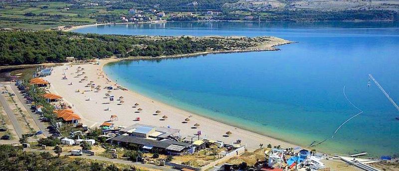
Dugi Otok (translated = Long Island) is famous for its many beaches and coves. Of which Sakarun and Telašćica are the most prominent.
Sakarun beach gained its reputation for the whiteness of the sand and the clean sea. It is surrounded by pine trees that provide welcome shade in the summer. It is about 800 meters long and at some 250 meters from the shore it is 3.5 meters deep, which means that the bathing area is extremely large and shallow and suitable even for young children.
Lighthouse Beach on Dugi Otok
Telašćica is also a natural park. There are three outstanding features to this park:
- The bay of Telašćica is one of the most secure, beautiful and largest natural ports on the Adriatic. It consists of 6 islands and reefs, 25 bays, and 69km of indented coastline. It is an attractive place for many sailors.
- Cliffs rising up to 200m above sea level, while underwater can even reach a depth of 90m. Many birds nest there, including many types of hawks.
- Mir (peace), is a saltwater lake full of therapeutic mud, it also is home to an endemic species of eel called Kajman.

Mir Lake on Dugi Otok Island
Telašćica Nature Park is located in the southeastern part of the island and with the surrounding waters as well as 13 islands, islets and rocks it makes a great nature reserve on 70,5 km2.
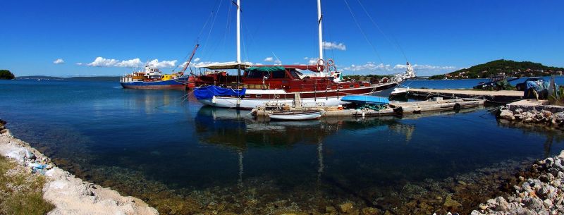
The Island of Prvić

The Island of Prvić
Sepurina on Prvić
Prvić is an island located between the mainland towns of Vodice and Sibenik and is very close to the mainland.
The total area of the island is just over 2km2. It is 3km long and between 500-1300 m wide. Its distance from the Dalmatian mainland is around 1000m.
These islands shores are safe, accessible and ideal for swimming in their entire length.

Prvić Luka on Prvić
There are two villages on the island called Prvić Luka and Sepurina with an indigenous population a few hundred people.
One fascinating aspect is the absence of automobiles of any kind on this island. As a result, these villages retain their relaxing aura. On such a small island with only two villages, getting about to any desired location will take a maximum of 20 minutes on foot.
To reach “civilization” it only takes 30 minutes by boat to reach Vodice, Šibenik or Zlarin.
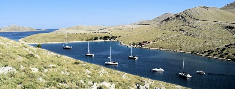
The Kornati Islands
One bay of many on Kornati

Some "Krunes" in the Kornati crown
George Bernard Shaw described Kornati in the following way;
"During the last days of creation,
God wished to crown his work and hence from his own tears, stars and breath created Kornati."

Kornati Islands - Aerial view
The islands of Kornat are considered heaven for sailors, nautical enthusiasts, divers and anyone in search of a private vacation. Kornati is rich in marine wildlife both of fish and seabirds that have made their homes there.
These islands are famous for the national park of the same name. Another famous characteristic of these islands is the kilometers of manmade terraces which made sections of grazing land for various domestic animals or olive groves.
Kornati National Park
Getting to Koranti is easy. Take your own boat, rent one, or go with an organized group from a nearby town.
There are 7 zones in N.P.Kornati which are specifically sectioned off for divers. Every one of those zones has its own charm and exciting experience waiting to be discovered. It's best to let the diving centers of nearby towns choose the best spots to go to which are sure to not be disappointing.
Another "Krune" of the Kornati crown
One of the most eye-catching parts of these islands are the cliffs of Donji Kornata (Lower Kornati), which face out toward the open sea.
These cliffs are known as Krune (krune - corona - crown) for hundreds of years, hence getting the name Kornati.
Website of Kornati National Park
Kornati National Park
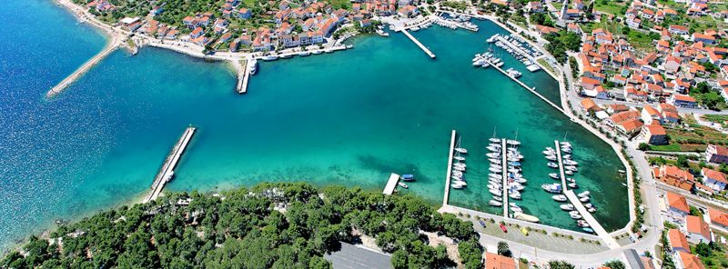
The Island of Murter

The Island of Murter

The Town of Murter
Murter is the starting point for the Kornati National Park, so its often called 'the doors to Kornati'.
There are four towns located on the Island Murter - the older ones, Murter and Jezera, and the newer ones, Tisno and Betina.
Technically speaking, Murter is no longer an Island; it is now connected to the mainland by a bridge in the town of Tisno.

Kosirina bay on Murter
An especially important archeological site, on Murter, is the ancient the Roman village of Collentum as well as many ruins of Roman villas, murals, and mosaic are located under the Gradina hill, in the town of Betina an additional indication to the importance of the location of this island.
The Beautiful sunny beaches and a wide variety of services described here are only a small part of why Murter is one of the most visited destinations in this region.
The Island Murter is famous for its sandy and gravel - beaches, such as Slanica, Kosirina, Čigrađa, Podvršak, Lovišća... There is also a large number of small bays hidden from view and far away from the turmoil of larger beaches.
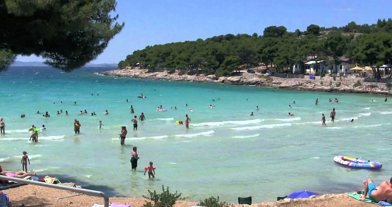
Beaches on Murter
The Island of Pag

The bridge to the Island of Pag
A map of Pag
Just north of Zadar lies the island of Pag. It has 270 km of indented coast and has one of the longest coastlines on the Adriatic, full of gulfs, bays, capes and beaches.
In addition to its scenic attractions, the island is known for its lace, cheese and salt.
The town of Pag is the main settlement on the island with 20km of sandy beaches.

The town of Pag and bay

Pag town - aerial view
One side of the island attains complete peace and serenity, while the other side is full of fun for the younger crowd on the legendary beach Zrće on which partying never seems to end day or night.
Today Pag is connected to the mainland by a bridge – but in terms of culture and produce it is still very independent and distinct.
Islanders farm the miserly soil and produce some excellent wine.

Pag Island, Novalja beach
Hardy local sheep graze on herbs and salty grasses, lending their meat and milk a distinctive flavor and producing paški sir (Pag cheese; soaked in olive oil and aged in stone).
There is also a real treat for divers in the region of Caske. In this area remnants of a sunken city can be found. Fragments stick out of the sand below the surface.
NOTE: Important
Consult local dive teams before diving. Strong currents occur from time to time.
Zrće Beach on Pag Island
The Island of Pašman

The Pašman strait

The Pašman map
Pašman can be reached by ferry from Biograd and from Zadar.
In the north, it is also connected by bridge to the island of Ugljan passing over the busy Zdrelac passage.
The "Pašman Strait" is a canal which consists of 10 small pearl-like islands that separates the island of Pašman from the Croatian mainland.
One specific island in the Pašman Strait seems to have made it into almost every travel brochure about the Adriatic.
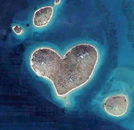
Galešnjak island
Galešnjak -
The heart shaped island
The island is located between the village of Mrljane on Pašman and the town of Turanj on the Croatian mainland. It is the iconic Galešnjak island (also called Island of Love, Lover's Island, Otok za Zaljubljene).
It is one of the worlds few naturally occurring heart-shaped objects.

Clear waters around Pašman island
The tides and shifting sea currents keep the waters around Pašman crystal-clear and clean.

Ugljan and Pašman - More than 100 km of cycling trails
Pašman - view from bike trail
With more than 100 km of cycling trails the islands of Ugljan and Pašman are a mecca for mountain bike enthusiasts.
The cycle paths lead through olive groves, to the top of the island’s peak and along the coast all in the same day and with plenty of time to stop off for a rest and a bite to eat.
The island has an almost tropical feel to it with plenty of lush green trees.
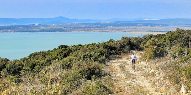
Mountain-bike trail on Pašman Island
Beaches on Pašman
Beaches on Pašman Island

Ždrelac – Soline Beach on Pašman
Ždrelac – Polača: Beach in a small quiet bay ideal for those wanting peace and rest.
Ždrelac – Soline: Paved concrete, sandy in the sea, this beach in the town center provides amusement for all generations.
Ždrelac – Matlovac: A small sandy beach next to the pine forest that delights both young and old. Playing in the sand or going down the waterslide are just some of the amusements. Plenty of refreshments can be found in some of the nearby cafes.

Dobropoljana Beach - Pašman Island
Banj: A small beach that will delight those that want to learn rowing or sailing on the old sails-boats or play a game of bowls.
Dobropoljana: Small sandy and along the extension a large and pebbly beach. Nearby Cafes it offer a variety of cocktails …
Neviđane - Lokva: The sandy beach is a few hundred meters long and perfect for families with young children. The shallow sand stretches deep into the sea.

Mrljane – Barotul Beach (swamp end) on Pašman Island

Mrljane – Barotul Beach - Pašman
Mrljane – Barotul: The largest sandy beach on the island is a mystique for itself.
Shoals extending to several tens of meters make it perfect for all ages. Teens will play volleyball during that time or sleep in the pine shade and start hunting for a number of shells hidden by the bottom of this small bay.
Mrljane is also known for its small swamp which has a mud that is purported to have healing qualities.

Lučina Beach on Pašman Island
Jasenice – Pašman settlement: The beach has both a paved and a sandy part. It is supplemented by tennis and volleyball courts from one side as well as "granddad’s bowling alley".
Lučina: This is another beach that is chosen by parents with small children. For the grown-ups there is a large sun deck, and for the youngsters, a shallow sea. This beach caters for fun for the children and peace of mind for the parents.

The clear waters of Tratica – Kraj Beach on Pašman Island
Tratica – Kraj settlement: This jewel of as golden beach next to the small settlement is perfect for early mornings or hot afternoons. For a drink from the nearby cafes and some good ice cream. Perhaps the most beautiful time is spent during late night dips.
Ugljan -
The Green Island
The Town of Kukljica – Kukljica Bay, Ugljan Island
Ugljan is located several miles west of Zadar, and is connected by bridge with the island of Pašman. They call Ugljan "the green island" because it is entirely covered by pine forests, olive groves, figs trees, vineyards and many other types of Mediterranean plant life.

Juzna-luka-beach – Ugljan Island
A 2000 year tradition in olive plantations left hundreds of thousands olive trees from which olive oil of impeccable quality and aroma is still made today. The inner hills and lower mountain regions of the island are made up of many roads ideal for hiking or mountain biking tours. An unforgettable panorama can be seen from the Venecian forts of St.Mihovil (XIII cen.). Artifacts from the Roman empire can be found here and are proof of ancient civilization on this island. Old Croatian churches, monasteries, stone architecture and vacation homes can also be found.

The Olives of Ugljan Island